From: Dufton to Garrigill
Distance: 15m / 24km
Cumulated distance: 700m / 59km
Percentage completed: 59.2
Yesterday was a big day. We climbed to the highest point of the Pennine Way, indeed, to the highest point of my entire route. Nick and Joanna were fabulous companions and I was massively grateful that for another day, I had no pack to carry. Joanna had arranged a bag transfer for four days! Bliss.
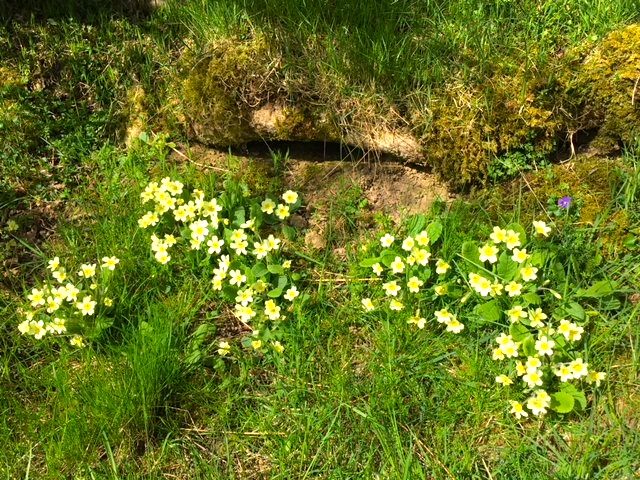
Wild primroses in the sun
The day started out very pleasantly, following the path of the river. The scenery was pretty with wild flowers, trees and meadows, either side of a woodland path.
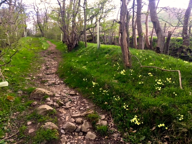
Prettiest of paths
However, there were very real signs of gales or storms in the recent past, with trees torn from their roots, blocking our way.
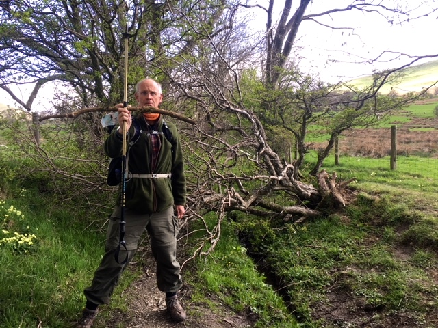
‘None shall pass’
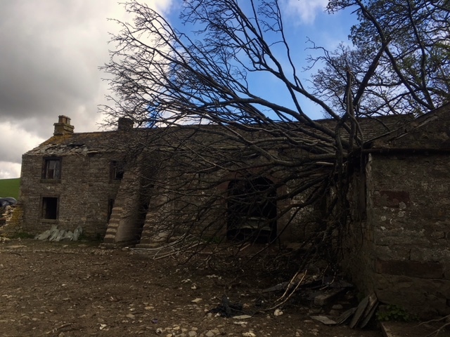
Roof problems
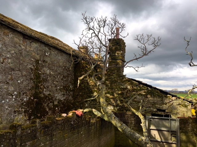
As Joanna said, this was probably the last straw
Sheep with their gambolling lambs scattered the pastures. It really seems that each day they try their hardest to be doing something different to catch the eye of the photographer, so that they’re guaranteed a spot on the blog. This little flock were putting in the extra effort!
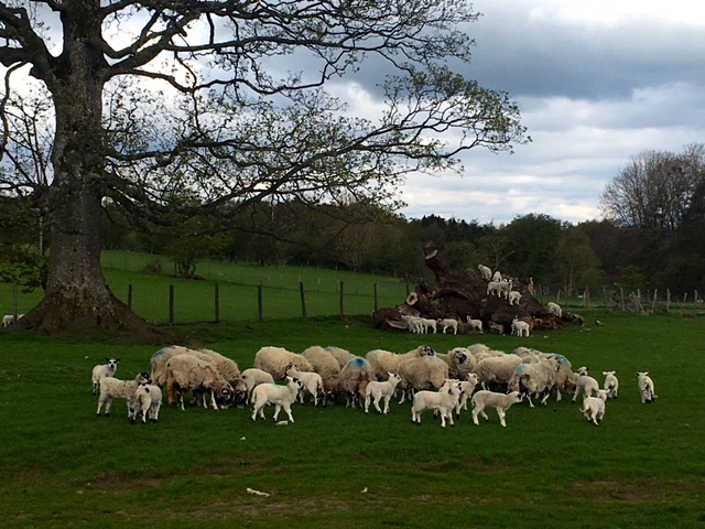
Lambs playing on tree trunks
A field of cattle competed with them for cuteness, although we were probably a little wary to spend too much time watching and getting the right frame.
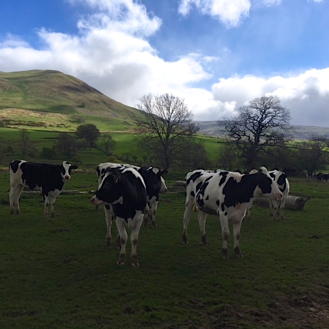
Fresians
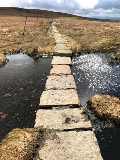
But before too long we had to leave the path behind and forge a way past Sillyhall and Bleagate farms to reach Great Rundale Beck. There have been many bridges along the PW, all beautiful in their simplicity.
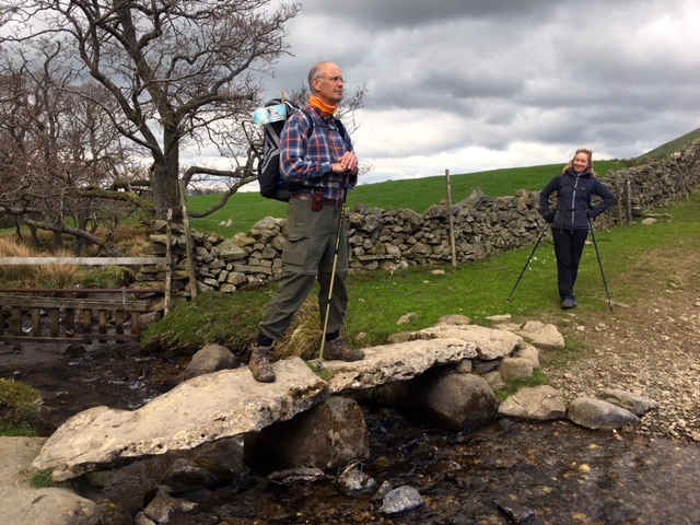
Joanna looking a trifle sceptical of Nick’s ‘bridge pose’
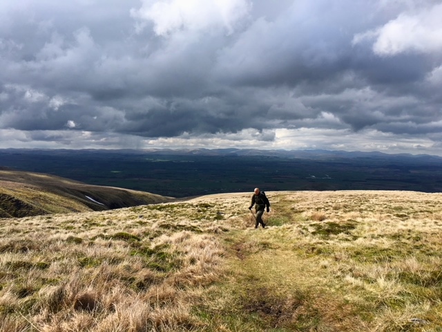
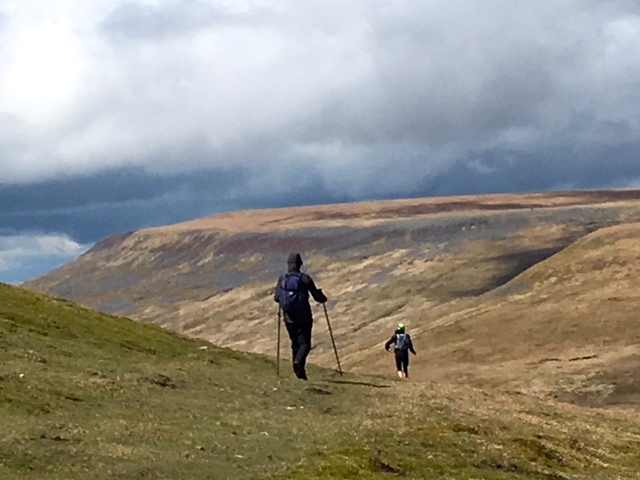
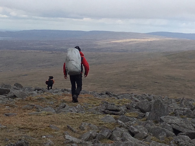
And then we started our climb to the first high landmark of the day: Knock Old Man. Eden Valley’s pastoral beauty ended suddenly and we were soon back to open moorland. The going was good .. dry springy grass which was kind to the feet, with patches of paving stones to help avoid any bog. The climb was steady and started to afford wonderful views of Dufton and the surrounding panorama.
Looking back
Today’s climb included the three highest summits of the Pennines .. Great Dun Fell, Little Dun Fell and Cross Fell (2930 ft). No other part of my walk gets this high. As we reached the empty river bed, we saw the last of the sheep for the day .. in fact we saw the last of anything, so bleak and empty was the terrain.
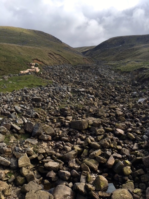
Empty river path
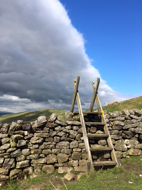
Beautifully crafted stile
Last vestiges of snow in shake holes
Breath-taking views across the Northern Lakes
Pockets of snow to practise bending zee knees
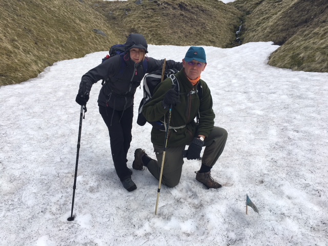
Joanna and Nick planting the flag
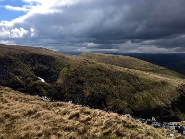
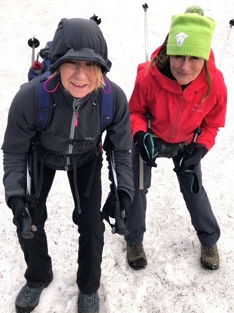
It wasn’t snowing at this stage but it was pretty chilly, with what Nick called ‘a stiff breeze’ and Joanna and I called ‘a raging Baltic gale’. With hoods up and extra layers keeping us warm we carried on climbing. Yet again I was impressed with the laying of great slabs of stone to make the way an easier and safer walk. All the tales of people sinking in bogs must have become a thing of the past with this wonderful feat of labour.
Fantastic PW path
As we were scouting for a place to eat our lunch, we were passed by a fell-runner. By the time we’d taken our first bite of sandwich, he’d reached the Civil Aviation air traffic control radar .. the giant golf ball. It was difficult to believe just how fast he was running.
Joanna overtaken by the fell runner
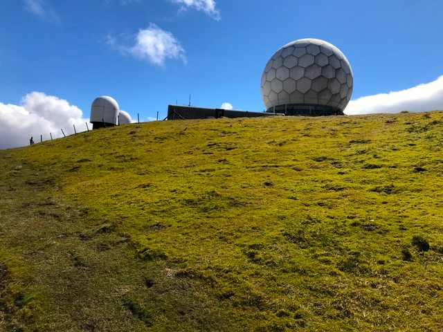
CAA golf ball
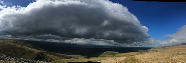
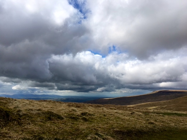
The views were staggeringly beautiful. No photograph can capture just how beautiful they were. The Solway Firth came into view and I could see all the way to Scotland! My first view and very, very exciting. We were lucky to have such clear weather, given that on many days, there is mist and rain up on the tops. We did get hale and a flurry of snow .. but that just seemed to add to the fun.
Spectacular skies over my first sighting of Scotland!!
Just before we reached the summit of Cross Fell, a sight came into view to beat all sightings .. a black labrador, with a rapidly wagging tail and his own red backpack, which we later learned carried all his food. Meet Seph. He and his owner Eddie are walking all 15 National Trails to raise money for Alzheimer Research. He was the liveliest of labs and clearly loving the challenge. Once I have the link I’ll put it on the blog for you all to visit .. sure it’ll be a fab read.
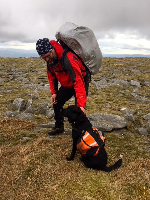
Seph and Eddie
Walking off to complete the PW
At Cross Fell there were views stretching to the coast in both directions. It’s one of the most isolated spots in England, with the nearest village being six miles away .. I can almost hear my Aussie mates guffawing at that! It’s also the highest point of the main watershed of England although there are eight higher summits in the Lake District. The summit plateau is pretty featureless and it’s easy to mix up one cairned path with another, but we soon found the correct route on the non too promising sounding Corpse Road. Thanks to Nick’s fine navigational skills.
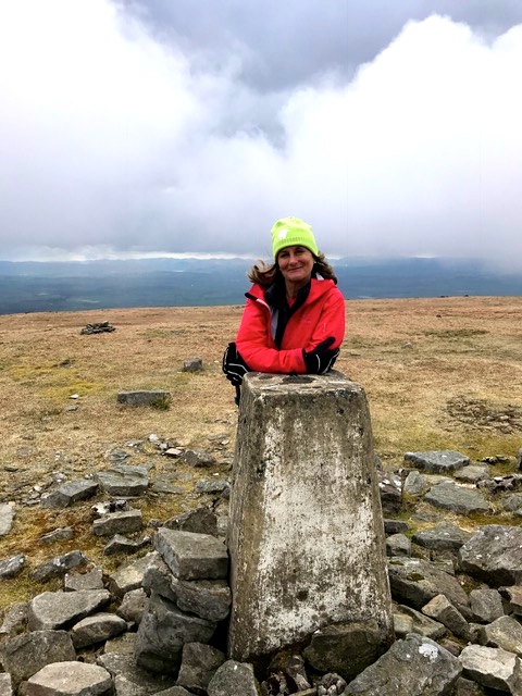
Highest point on Walking The Black Dog
All across England there were once corpse roads, which were used to carry corpses to consecrated ground for burial. The one from Garrigill to Kirkland is probably the longest, highest and the most treacherous in the land. In fact there are stories of corpses lying in virtual freezers along this particular corpse road, when storms and blizzards were suddenly whipped up, forcing the pall-bearers to abandon the recently deceased. Not too surprisingly there’s a lot of folklore surrounding corpse roads .. it’s not by chance that they don’t cross rivers, walls or fences. Spirits, despite having other magical properties, seemed not to be able to get across them! It reminds me of the small step barrier at the entrance to many old Chinese houses in Singapore, which were supposed to prevent evil spirits from entering. It’s amazing how superstitions are the same the world over .. just interpreted in different way. Anyway, it’s eight miles to Garrigill and I was rather thankful that there would be no wall to climb or rivers to forge along the way.
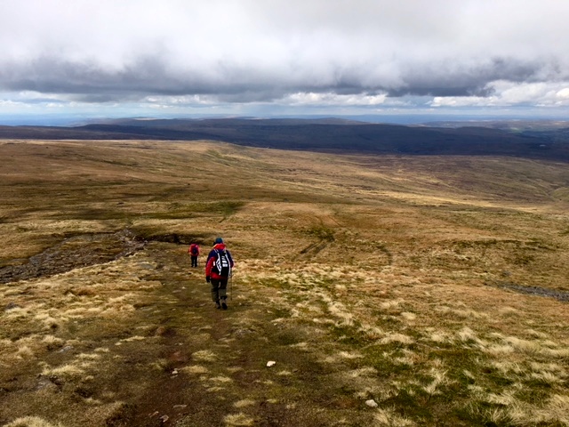
Walking along the Corpse Road
On the way we passed by a former miner’s cottage, known nowadays as Gregg’s Hut. It’s a rude bothy used as a bad weather shelter for walkers and is most likely UK’s highest inhabitable dwelling. It also has a little lawn to welcome those lost in a storm .. but electricity and running water are sadly not on the list of amenities.
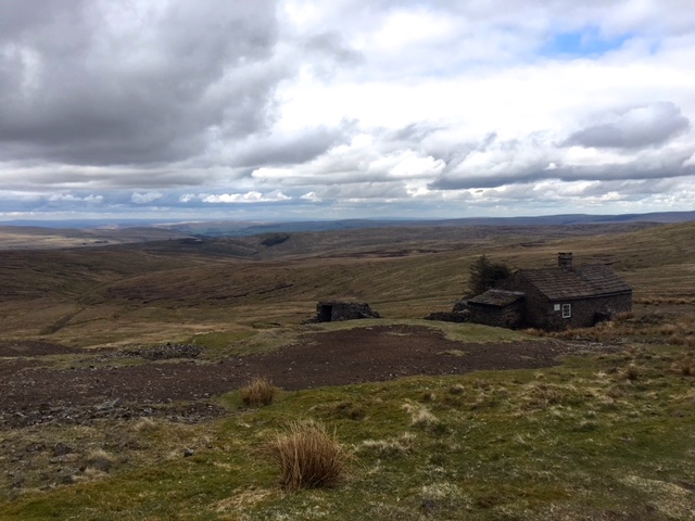
Gregg’s Hut
The bothy was refurbished as a memorial to John Gregory who died in 1968, when he and his climbing friend Richard Broxap were attempting the High Level Route from Saas Fee to Argentiere. It is one of the finest memorials I think I’ve ever seen .. a wonderful refuge and probably saving lives to this day, if the visitors book is to be believed.
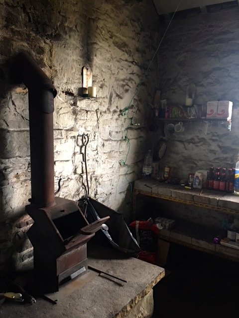
Essential provisions at Gregg’s Hut
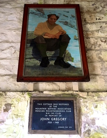
Portrait of John Gregory
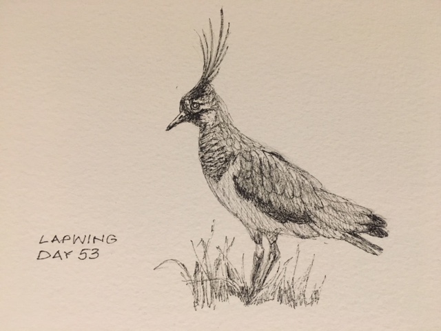
We continued our descent into Garrigill. Wainwright reckoned it to be the quickest and easiest section of the whole PW. And indeed it was, although the featureless character of it meant we eventually resorted to playing some very silly alphabet games to distract us from the remaining 8 miles to be walked. Angry Astronaut, Busy Butcher, Callous Chemist, Devious Doctor .. you get the picture. We knew we were returning to civilisation when sheep once more became part of the landscape, along with lapwings and black grouse.
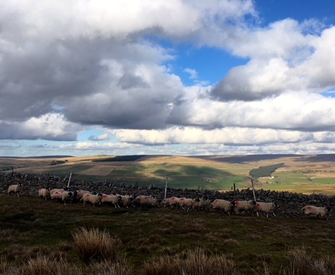
Returning sheep
Garrigill is but a small village with a tiny green, which on fine days I’ve heard can be strewn with collapsed weary walkers. I was so glad I’d chosen to stop here rather than walking the extra 4.5 miles to Alston, even if it is a market town with more facilities. The elusive George and Dragon provided us with food and various other entertainment for the evening, although I have to say I was in bed fast asleep by 9.30. It had been a long but hugely satisfying day.
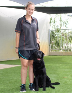
Black Dog Tails
This is Buddy training to be an assistance-dog in Western Australia.
![]()
Fabulous days accomplishment and sounds like much fun had by all. Got to love those alphabet games! Our favourite for walking is….I went to the supermarket and I bought a….’ you have to repeat them all before you add yours next
I played it with your boys in the Cotswolds!! But only after we’d placated Swampy by playing I Spy. xx
What a great photo of you Jules at the highest point of the Black Dog trail. Pete and I are loving your story.
Thanks Sarah .. that’s lovely to know. Shauna and Adam were great company over the last couple of days and now I have John and Beck with me for three! How lucky am I. xx
A day of contrasts – primroses to corpses – never a dull moment! Photos as extraordinary as usual – the landscape is just incredible… And Scotland on the horizon…soon be time to start #looking for Jamie 😁 Lots of love xx
Got to ask .. who’s Jamie?? xx
Hi Jules, I am so enjoying reading your blog as it is reminding me of our walk in the opposite direction in 2010. Our day walking from Garrigill to Dufton was the scariest day for me. We were completely shrouded in cloud all day and I was thankful for my dear husband’s skill with a compass to find those cairns over the top of Criss Fell. We did not stop for lunch until we were descending into Dufton about 4 pm and I broke down and cried with relief at making it across. Your views looked amazing. I’m pleased you had company for that day particularly. Well done. Cheers Debby
I’ve heard similar scary stories, Debby. We were so lucky to have such a clear day, even if it was bitterly cold. Thank you for your messages.
The scenery is absolutely fabulous and the photos you are taking (with an iPhone as Patrick told me) on this trip are stunning.
Thank you Bernd .. iPhone’s are magical things!
What a true relief it must be to walk without your 9kg backpack Jules ! That was a very happy smile on your face at the highest point on Walking the black dog , not long now , you can see and smell Scotland my friend xox
It was like walking on the moon at first!! Scotland is within my sights now .. and so too are you!! xx