From: Horton in Ribblesdale to Hawes
Distance: 14m / 22.5km
Cumulated distance: 622m / 1001km
Percentage completed: 60.5

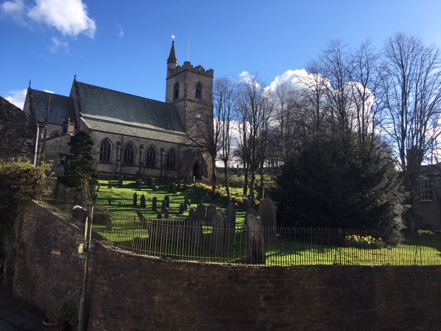
The Red Tops ‘Phew what a scorcher’ of yesterday was replaced with a return to grey weather in the Dales yesterday. There was a hint of a sunrise from my over-priced pub window, of St Oswald’s church .. but still no hint of wifi. Managing to set off the alarm in search of a non-existent breakfast we got off to an early start.
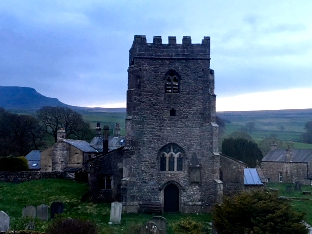
The 12th century church of St Oswald’s in Horton in Ribblesdale
As we passed the campsite there were streams of people emerging from a huge variety of tents. Some groans from sleepy-heads but many campers dressed and ready to go walking, climbing or pot-holing. The area has an abundance of interesting pot-holes and indeed we’d had a very jolly conversation the previous evening with a bunch of military guys who had been underground for the day, celebrating a stag night. Apart from the best man, they were all very enthusiastic about it!
Caves and potholes form a major part of the Dales’ limestone landscape. It’s known as karst and the Yorkshire Dales National Park is apparently the finest and most extensive example in Britain. There are over 2500 known caves in the area, including the longest system in the country .. The Three Counties and the famous large chamber of Gaping Gill. There are popular caves for beginners such as Long Churns, with its famous squeeze called the Cheesepress.
What I didn’t realise is that caving is not all about crawling. There are magnificent stream way passages where the ceiling is high and there are massive great chambers too .. Gaping Gill is large enough to accommodate St Paul’s Cathedral! I was astounded to find this out and wish I had photos to show you .. but we were strictly above ground yesterday. And finally, the guys were telling us that if you think it is dank and gloomy down there you need to think again. There can be beautiful passages and shafts and calcite formations such as stalactites, stalagmites, curtains and flowstone, which can be utterly beautiful and serene. Unless you suffer from claustrophobia, of course.
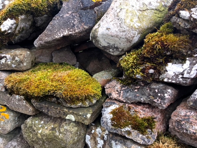
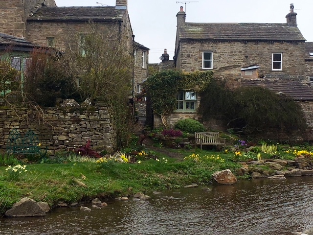
Limestone in the walls
The caves of the Yorkshire Dales have formed in limestone rock over a period of many thousands of years. Limestone is a strong rock but has many joints and cracks and is also soluble in rainwater, although this happens extremely slowly. Spray erosion near underground waterfalls makes the underground spaces very gradually larger and I guess, unstable. In larger chambers walls and roofs collapsing can speed up the erosion .. making pot-holing one of the less safe adrenalin sports. As much as I like the idea of standing in the underground equivalent of the nave of Westminster Abbey, I don’t think you could tempt me down there.
We knew before we set off yesterday, that we wouldn’t be passing any pretty little villages or market towns along the way. We tried to stock up on stuff for lunch but the cafe was not yet open .. what a wasted opportunity with the scores of hungry campers right next door! But Jill had chocolate and apples; I had crumbled biscuits and tea. What more could we want! As we walked out of the village we came across a tree adorned with discarded walking boots. Some good stories there.
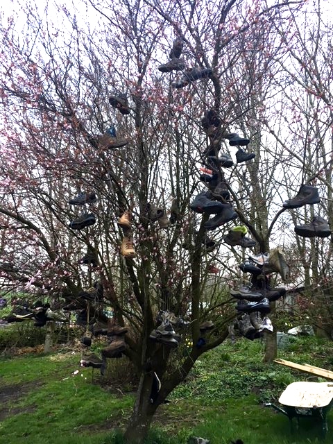
Boots with a history
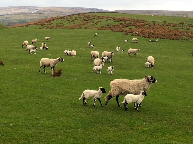
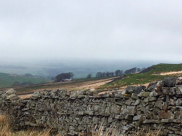
Fields either side of the village road had backdrops of the lovely Dales, where many of the campers were headed today for a good walk. There was even a Cornish chough in one of them, to my surprise and delight! As the beautiful writer J Butler puts it, ‘Here again are drystone walls, stone barns, emerald green pastures, streams doing disappearing acts, jumbles of grey-white rock pavement and numerous potholes’.
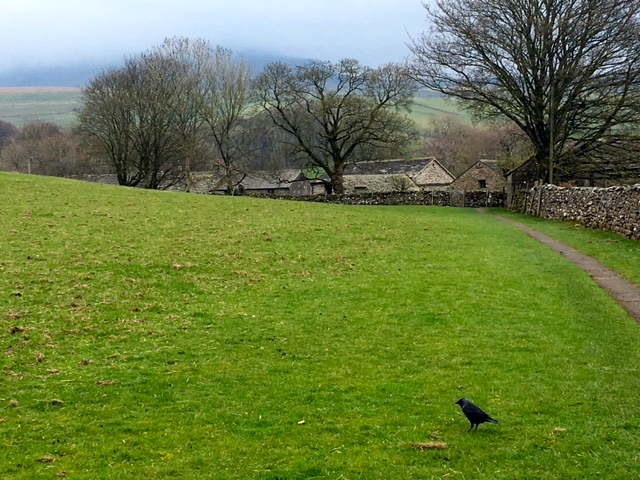
Cornish chough masquerading as a jackdaw
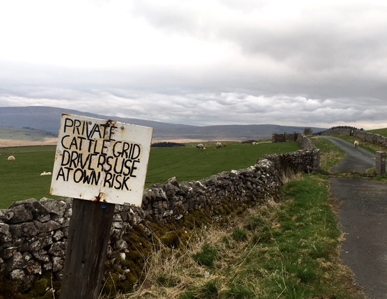
Our plan was to walk a combination of the Pennine Bridleway and Pennine Way to Hawes. A country track took us up to join the Bridleway. Along the way we had a couple of fun runaway sheep encounters. There was a group of six, who looked as if they were sheepishly returning from a night on the tiles only to find themselves locked out of the field. One after the other they scrambled over a slight dip in the wall and then looked airily around as if to say, ‘party, what party’. And then we followed a lone sheep with a red number five sprayed on his backside. He skipped along the road for at least a kilometre and when he arrived at the cattle grid skipped over that too, joining his fellow number fives. So much for cattle grids .. or maybe that’s why they’re called that and not sheep grids.
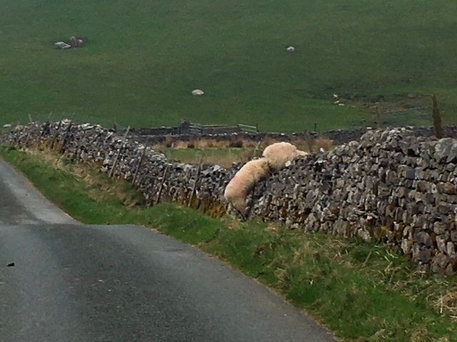
Revellers returning
Made no difference to our sheep
A warm welcome to the prodigal
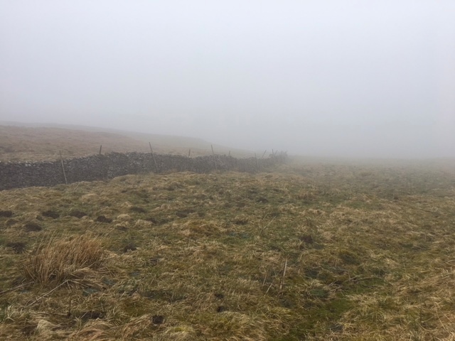
As we climbed, the weather started to close in. We were passing some of the most wonderfully named areas .. Dismal Hill, Sheep Scar, Fair Bottom Hill, Calf Holes and a liberal sprinkling of shake holes. It started to look bleak. I was sorry for my friend who I’d like to have seen more sun but actually I find this sort of bleakness quite exhilarating, with a beauty of its own. My friends think I’m completely bonkers. There were magnificent cloud formations and the views across the Dales remained at least clear for a good couple of hours.
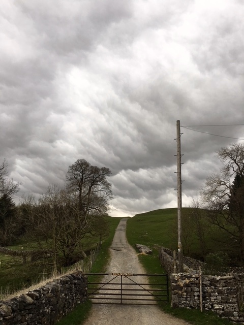
Weather on the horizon
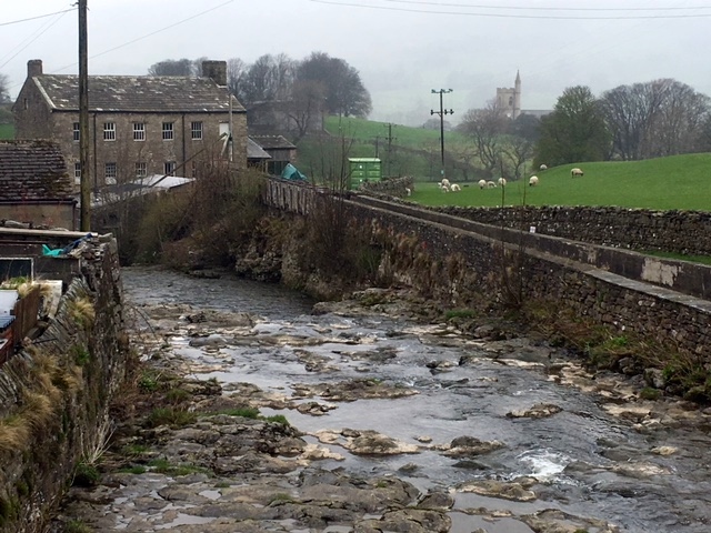
To the west of Sike Moor we came to a beautiful tumbling waterway called Ling Gill. From the path we could just about see the great chunks of limestone through which the water crashed. Reading afterwards I discovered the secretive path of the ravine has been seen by very few. It’s an extremely difficult climb, full of caves but those who do descend are treated to a magnificent, savage beauty. I came across this blogger, brave enough to descend into the ravine. His photos are sublime. http://oldfieldslimestone.blogspot.co.uk/2013/06/ling-gill-limestone-wild-and-untamed.html. We made do with crossing the gritstone bridge which dates back to the 17th century. It’s thought it was a crucial passageway on the ancient packhorse route to Ribblehead. It remains significant to this day, as this is where the Pennine Bridleway crosses the Dales Way, another long-distance footpath.
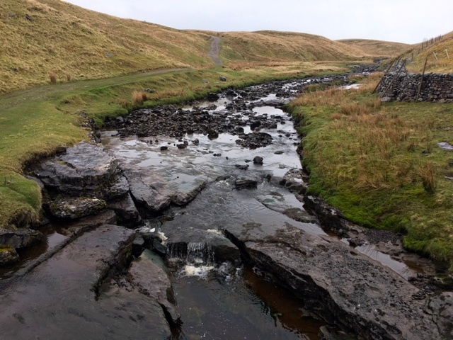
Ling Gill Beck
We passed a couple of cairns which in days gone by would have been crucial for guiding travellers. It wasn’t difficult to imagine how treacherous the area could have been without them, especially with the random pools of water and numerous pot holes.
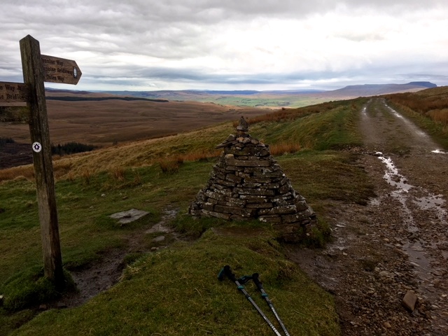
Cairns marking the route
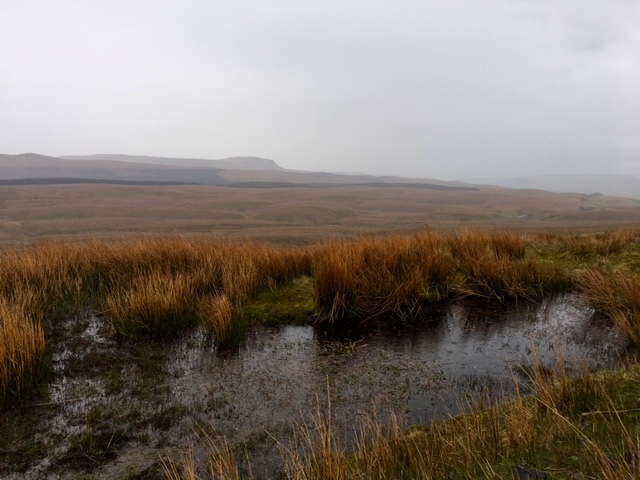
Would have been wet underfoot
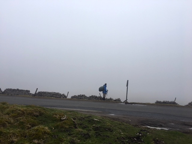
Eventually, getting to the highest point in our day the views proved well worth the long, steady climb. And by the time we came to look across Oughtershaw the wind was so strong we felt we could probably fly under our own steam into the valley. The Pennine Way at this stage uses an old Roman road: Cam High Road, which like most Roman roads of that time is arrow straight. The Dales Way drops to the right, into the Oughtershaw valley. The Pennine Way heads onwards, along the top of a windy moorland ridge, eventually reaching the limit of the tarmac road at Kidhow Gate.
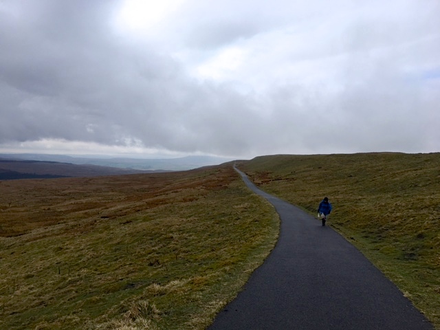
Jill walking ahead on the Roman road section of the path
Having a complete lapse of concentration I led my friend to continue on the tarmac road, all the way down to Hawes instead of turning left and keeping on the Pennine Way. It was a terrible, basic mistake which I thought I was well past making. Thankfully it still meant that our destination was Hawes and didn’t add much distance to the day. Jill was very forgiving, despite the fact that I’m sure her feet were beginning to hurt and tarmac was not the best of surfaces for her to be walking on. Sadly, the views also evaporated at this stage and we were looking out into a virtual void until we reached the Sleddale valley.
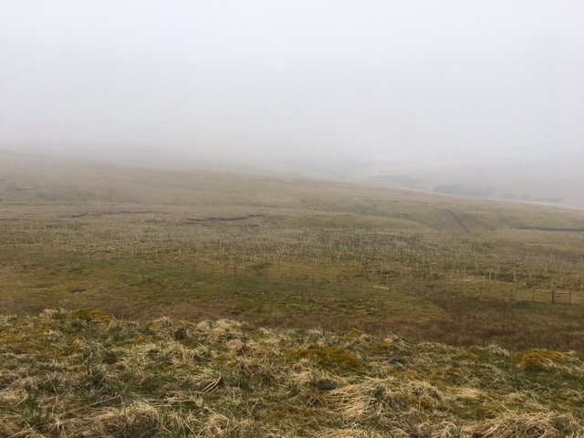
Disappearing horizon
Same in the other direction
Jill looking into the void
There was a steep descent down into Sleddale Valley, the mist and rain clearing half way down.
Emerging from the cloud
Before we walked into Hawes we passed through the pretty little village of Gayle, where the Sunday afternoon peace was being shattered by motorbike riders doing dare-devils across the ford. Jill was very taken with the old Massey Fergusons parked close by, which were similar to ones she used to drive as a child in Western Australia. Feisty people these Aussies.
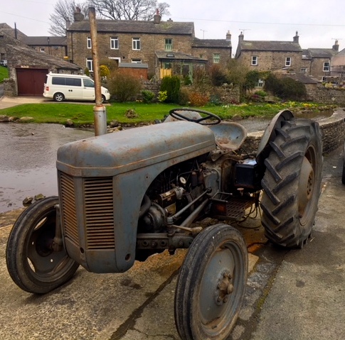
Tractors for kids
Gayle village
Gayle Beck
And then on the few extra yards to Hawes. This magical little market town is England’s highest, set 850 feet above sea water. The name Hawes means a ‘pass between mountains’ and it stands between the stunning Buttertubs and Fleet Moss. It was first recorded as a market place in 1307 and the Tuesday market still brings in the crowds. It is also the producer of Wensleydale Cheese. Speaking of which, can you guess what Wensleydale cheese has in common with Arbroath Smokies, Gloucester Old Spot Pork and Champagne ..
Sun returning as we finished our walk
In celebration of my passion for sheep and the runaways I bought a new hat to replace my lost today in Hawes, from the lovely Herdy shop, named after the Cumbrian Herdwick breed of sheep. By the way, my sister once bought me a Herdy teapot with a tiny sheep sitting on top of the lid .. not obsessed at all!
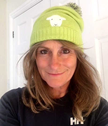
Herdy hat
Thank you for your patience, Gentle Reader, for bearing with me as I sorted out the bandwidth issue I had with the blog .. all made more complicated with an Aussie/Pom time difference. Hopefully it’s a thing of the past thanks to Shona and Michael.
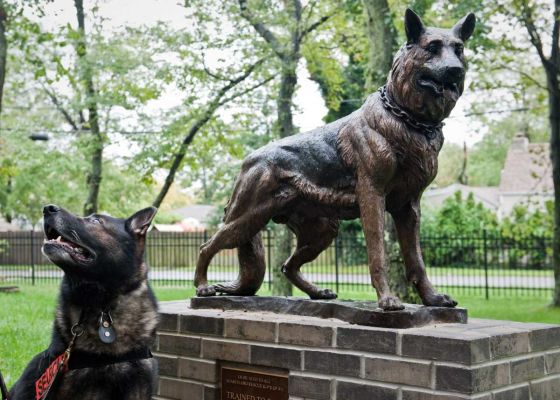
Black Dog Tails
Here’s handsome Hansen, posing next to his very own statue, commemorating his part in the 9/11 rescue.
![]()
Ah! All nostalgia and familiarity for me – a welcome breakfast read.
That early breakfast thing is a nuisance – I often ask them if they will prepare something for me the night before to leave out and often find I end up with a superior feast to what would have been the standard issue, albeit not a cooked breakfast. Whatever, it’s better than nothing especially if your route doesn’t pass through anywhere to buy food anytime soon.
You’re quite right .. and today we’ve requested the packed lunch, with tray bake!
Dear Jules – I’m relieved to hear you find the lowering skies invigorating…a real asset!! Spectacular scenery – a real education and so glad you’re back online – was almost reaching for the tranquilisers at this end! Hope tonight is more luxurious. Love always xx
Thank you, dear Frannie. You make me smile with the image of you reaching for the tranquilisers! Much more luxury in Hawes, pleased to say. xx
Who says that sheep are stupid?
I can’t believe how fast this little red dot travels North on your map. You must be thrilled that the (Lands) end is far away by now.
Is there any royal fever to be felt or celebrations in the pubs that far from London after the birth of yet another heir to the throne? Do they know yet up North?
Keep on trotting!
The red dot moves so much faster now that I’m travelling due north most days! I occasionally see the tv news and yes, there are lots of pics of the new royal baby (how DOES Kate appear looking so radiant just hours after delivering) and of course, you’ll be here for the wedding! xx
Dear Jules,
I have so enjoyed your travels through your blog! You have such an eye for the beauty in the world around us! I think I also look forward to your beautiful sketches as much as your adventurous tales! May God continue to bless you with gifts of wonder along the way and keep you safe and warm!
Love and Blessings!
Jacque
Thank you so much Jacque .. won’t be long before you and Guy are over here for the WWOM. Hope you sorted out some good gardening tours. Jx
Absolutely love the hat Jules! Still can’t believe you have made it all the way to Yorkshire – you are killing it!!!
Have a great day tomorrow xx
Thanks Kate! The sun is out as I tap away at my computer so I think we’re up for a good day. xx
Jules you’ve walked over a 1000 km – what an amazing accomplishment! It has been such fun to follow your footsteps through the lovely posts and drawings that you compose for us daily. All the best!
Thank you so much Silvia! x
I had no idea about your obsession with sheep Jules , but totally understand how one could feel that way about those beautiful creatures (btw you should be a vegetarian) and I fully realise now how much you truly love all animals -except large rats , that I know ! –
A couple of other things …your old muddy boots ( where are they ? ) would be in good company in that boots tree and they could share stories with the others , just imagine the conversation 🙂 … the last thing I have to tell you is that I am saving in my photo library so many of your magnificent landscapes and moody skies as I read your daily blog , even if you decide to paint them on your return our respective renditions would be quite different , so interesting ! xx
p.s : Patrick’s beer story was priceless !
Yes, it’s a bit of a weird obsession but a very happy one to have on this journey, with the hundreds if not thousands of sheep and lambs! A few more photos for your library today with the mist that shrouded the landscape! The different painted interpretations might be an idea for a show!! xx
Dear Jules, goodie, the blog is back on! have been following your steps closely and love your fotos and stories. It is so impressive to see how far you have walked. That little red dot moves up mm by mm and yet you cover all that distance.
The boots on the tree I am sure have lots of stories to tell, so will yours! I suspect many more stories than the sneakers in Sydney thrown over a powerline. And I like your rebel sheep returning, or may be they are leaving- rebel either way. You have captured many moments that I am sure one can only appreciate walking. Thank you for sharing these moments! lots of love
So lovely getting your message, Amely. There are many humorous moments along the way .. so glad you like them! xx
I hate over-priced pub windows!!
You’re SO on my wave-length!!
That Fergy looks like the one I’m still using…..indistructible
Aye, they make ’em robust!